
What Airport Should You Fly Into?
We flew into Phoenix International Airport. It was a two hour drive to get to Sedona.
Activities to do in Sedona
There are many activities you can do in Sedona. Hiking, mountain biking, 4×4, fishing, shopping, etc. You can see everything Sedona offers here.
There is a fee to park at the trailheads
If you own an America the Beautiful pass (national park pass), this covers your parking fee. If you do not own one, you will need to pay to park. Learn how to purchase a Red Rock Pass here.
Restaurants in Sedona
Sedona has many great restaurants. Reservations are recommended for most places. We ate at the following restaurants for dinner.
Elote Cafe (a really popular place – good food, but I liked Mole better)
Mole (my favorite restaurant out of the three – excellent short rib tacos)
Pisa Lisa (amazing salads, good pizza)
Where We Stayed
Hotel & Accommodations are expensive in Sedona. I found it difficult to find good hotels under $200/night. This most likely was because we visited in peak season (early April). We stayed at Arabella Hotel. The hotel was clean, spacious, centrally located and offered a great free breakfast.
Hiking
Sedona is known for hiking as they have hundreds of trails to choose from. We did three hikes.
My 3 Day Itinerary Expanded
Day 1 – Drive to Sedona from Phoenix
We rented a 4×4 vehicle for this trip just in case we needed it. Once we arrived into Sedona, we checked into our hotel then headed out for a sunset hike.
I always download every hike on the AllTrails app. This hike was about 15-20 minutes away and it allowed us to drive through the heart of Sedona.
Birthing Cave
Distance: 2 miles
Elevation: 291 feet
Since we went late in the day, we had no issues with finding a parking spot.

Day 2 – Two Hikes
After a scrumptious breakfast at the hotel, we headed out early to Boynton Canyon trail. We arrived by 8 am so parking was not an issue. Getting up early also helps with beating some of the afternoon heat.
If you want to see Subway Cave, be sure to download a GPS map on AllTrails as it is easy to miss on the trail. We veered off to the Subway Cave first then went to the end of the trail after. I was not too impressed with the trail after seeing Subway Cave. We did however spot a beautiful owl sleeping in a tree.
Boynton Canyon trail + Subway cave
Distance: 6.7+ miles (if including with Subway Cave)
Elevation: 826 feet+ (if including Subway Cave)
We finished the trail in the early afternoon. We stopped into Whole Foods for lunch then checked in with work. Afterwards, we walked downtown Sedona. You can easily walk from the Arabella Hotel. The hotel also offers free bikes to ride around town. We walked to Tlaquepaque, Sedona Arizona’s Arts & Crafts Village, grabbed an ice cream and simply enjoyed the nice weather.
Sunset – We headed to Crescent Moon Ranch (Picnic site) to get a nice view of Cathedral Rock. You cannot get a good view of Cathedral Rock from downtown Sedona and it requires you to drive out of time slightly. I wanted to capture some photos at Crescent Moon Ranch, but I was not seeing the shot I was looking for. Since there had been little rain, there were not any great puddles to get reflections of Cathedral Rock. I also learned you do have to walk across a stream crossing for potential other areas to photograph. I will try this next visit.
Note: there is a fee of $11 to enter into Crescent Moon Ranch
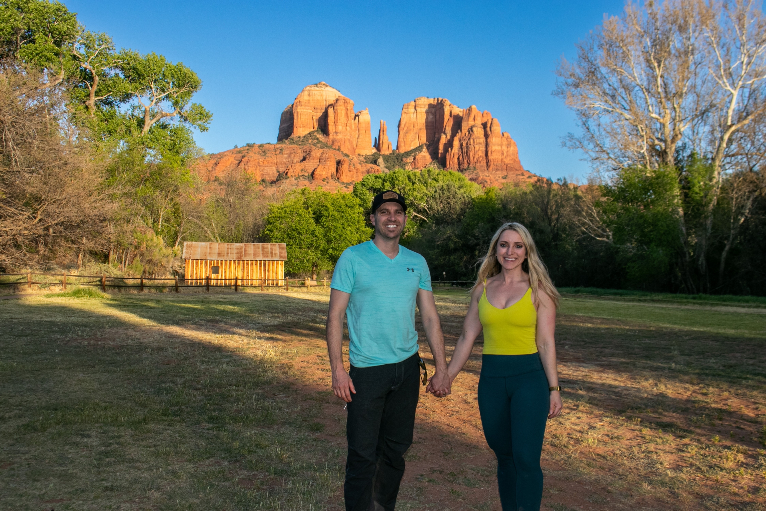
On the drive to Crescent Moon Ranch Picnic site, there is a hill on the left (with a parking lot) for another viewpoint of Cathedral Rock. We stopped by here also.
Day 3 –
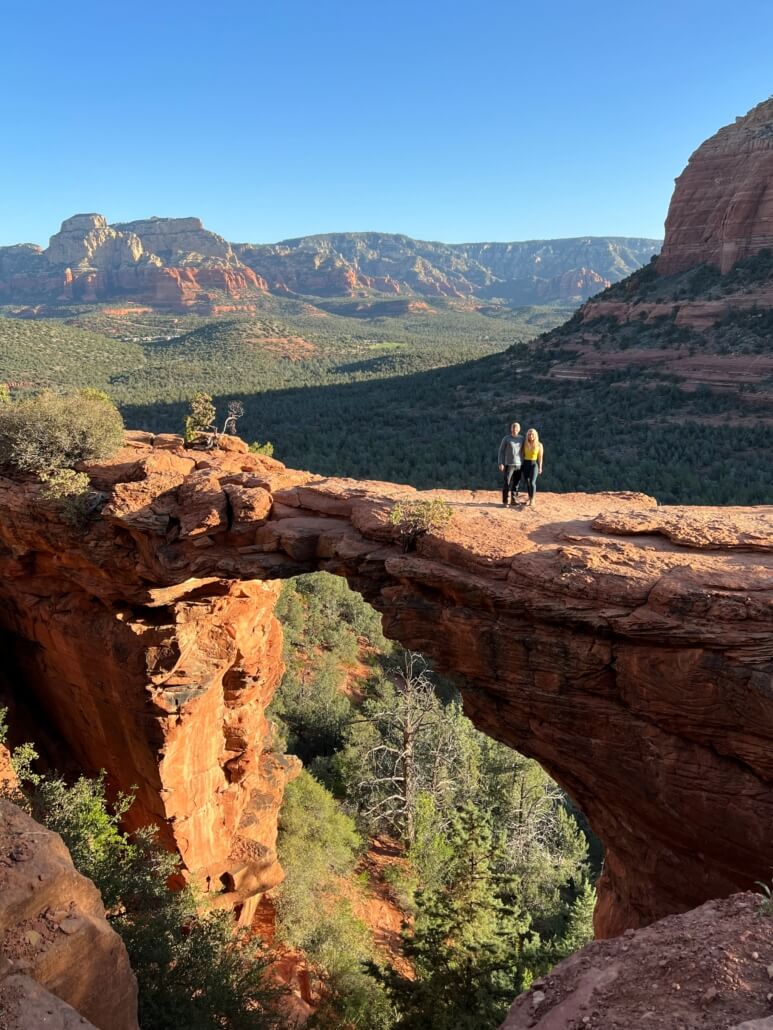
Our last day we did another early morning hike at Devil’s Bridge. This hike can be short if you have a 4×4 vehicle. The road is rough with some very large boulders to maneuver. I know I wouldn’t have felt comfortable driving on the road. Most people will park one mile away from the start of the trailhead. This requires you walking on a dirt road until you reach the start of the trailhead. If you have a 4×4, you can drive right up to the trailhead and then hike up less than one mile to get to Devil’s Bridge.
Devil’s Bridge Trailhead
Distance: 1.6-4 miles roundtrip (depending on where you park)
Elevation: 520 elevation gain
Since we arrived to Devil’s Bridge by 7 am, we had a minimal wait to get a photo on the bridge. I read people waiting over one hour to get a photo on the bridge due to large crowds. If I were to do this hike again, I would probably come at sunset, as I feel the lighting would have been a little better.
In the afternoon, we explored Slide Rock State Park and Grasshopper Point Swimming & Picnic Area. We watched people jump off a cliff & simply enjoyed the time around the water. Both areas require a fee to enter.
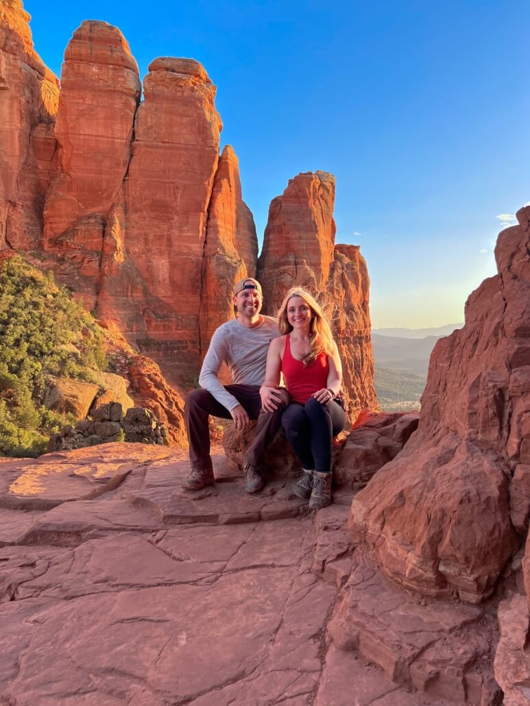
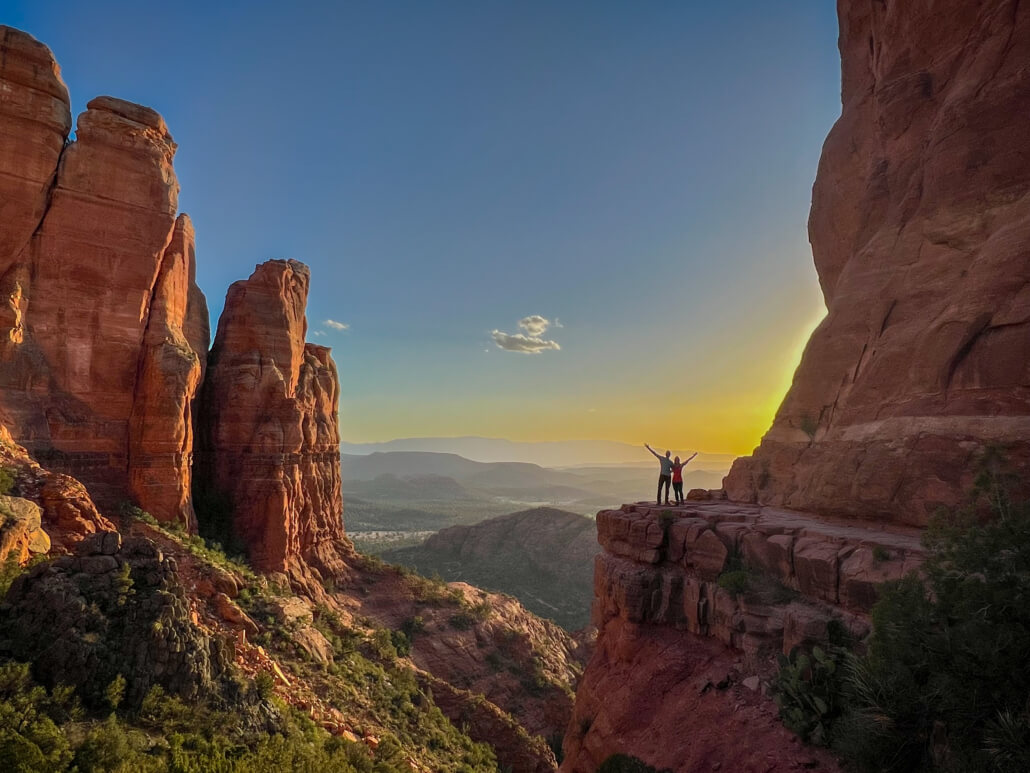
Sunset hike – Cathedral Rock
Distance: 1.2 miles roundtrip
Elevation: 741 feet
This was our favorite hike of the trip. It is short, parking is limited, and it does require a little bit of scrambling (hands and feet crawl). I highly suggest going at sunset.
My one mistake on this hike was not checking out the spire! Once you get up to the top, continue to walk left. There is a little trail where you can get a great close up view of the spire. I did not know this until afterwards.
Other trails to check out next time:
Solider Pass & Sacred Pools (early morning)
